
Topography refers to the study of the features and the shapes of the surface of the Earth as well as other objects which are slightly below or above the surface of the Earth like the buildings, trees, walkways, streets etc. The topographical surveys studies all these and provides a base map for the designing of the building or residence of some kind or even for the designing of a driveway or a road. Therefore the surveys often show the perimeter boundary lines as well as the lines of easements crossing the property or on it being surveyed which would help the designer to appropriately show the zonings along with other setbacks.
Objective of Topography
The main aim of topography is to determine the position of any point in with regard to a horizontal coordinate system like the altitude, latitude and longitude. Identifying and recognizing the features of typical patterns of the landform are also its part. The topographical surveys might be made for several reasons including geological exploration and military planning which have been the primary motivators to basically start the surveys. But for the planning and construction of any crucial public works, civil engineering or reclamation projects, a detailed information regarding the surface features and about the terrain would be required which can be received through these surveys.
Different Techniques of Topography
There are different ways of studying topography wherein the usage of a certain method would be dependent upon the size and scale of the area which is being studied as well as the quality of the prevailing surveys and its accessibility.
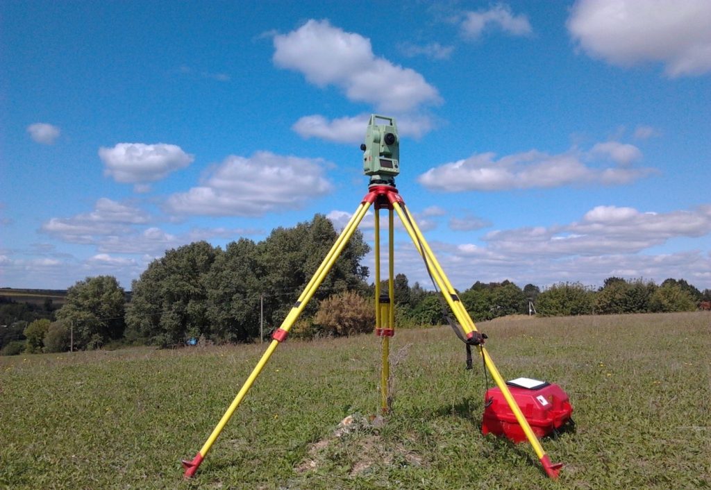
Direct Survey
Surveys help to determine the three-dimensional space or terrestrial space positions accurately as well as their distances and angles between them using instruments like the dumpy levels, clinometers and theodolites. Remote sensing has definitely sped up the whole process but, till date direct surveys provide the most accurate basic control points and the framework for all the topographic work be it manual or GIS based.
Remote Sensing
Remote sensing refers to the accretion of information regarding a phenomenon or an object without actually making any physical contact with the object and therefore in contrast with the on-site observation. It has been used in innumerable fields like land surveys, geography, ecology, glaciology and much more. In today’s times, it is done based upon the propagated signals which might be split into active remote sensing and passive remote sensing.
Photogrammetry
It is a kind of topographical survey wherein the coordinates of the points in 3D of a certain object are ascertained with the help of the measurements made in photographic images which might be two or more which would have been taken from different positions. In such a technique, identification of the common points is done on each of the images. A line of sight also known as ray can be built from the location of the camera to the object’s point. The intersection of its rays known as the triangulation determines the relative three-dimensional location of the point.
There are several other techniques as well. It is important to note that the surveys require certain benchmarks according to which the information regarding surface and determination of necessary setbacks are based.